Choosing a Location
Vancouver is home to many exciting and safe neighbourhoods. This guide will help you get your bearings.
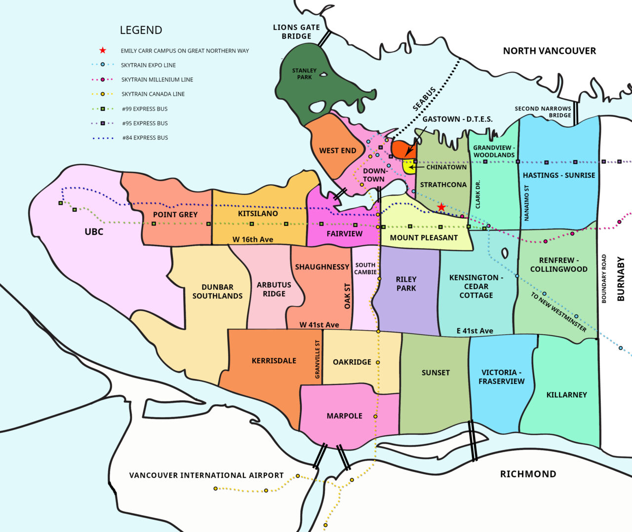
Map of Vancouver neighbourhoods.
Welcome to Vancouver! There are many neighbourhoods in the city for you to explore. This list starts with areas closest to campus. You may also want to consider surrounding cities, like Burnaby and North Vancouver, but be aware that while accommodation prices may be less, transportation times will increase.
Contact our Housing Support Office to talk about the possibilities.
Vancouver and the surrounding areas have a great network of public transportation. Visit the Getting Around section over on our Welcome Guide for links and details.
Closest to Campus
These areas are all located very close to campus. Most of these are within a 30 minute walk, except for Fairview Slopes.
East Van
Anything east of Main Street, all the way to Boundary Road (the division between Vancouver and Burnaby) is referred to as East Vancouver or East Van.
Downtown
Downtown Vancouver is surrounded by water on three sides and can be accessed by the Burrard, Granville and Cambie bridges, or by the Aquabus or False Creek Ferry - these are the little tugboats you'll see chugging along in False Creek. The Skytrain also runs into downtown. From campus, you can walk across the Cambie bridge in about 45 minutes.
Vancouver West Side
The west side covers anything west of Main Street all the way to west the University of British Columbia (UBC) and all the way south to the water. The areas listed here are within a 20 minute drive or a 30 minute bus ride.